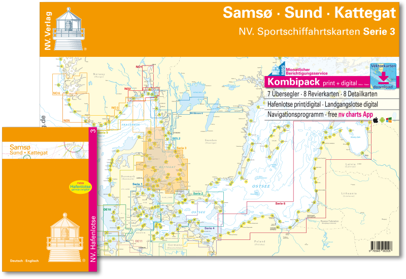
NV. Serie 3, Samsø - Sund - Kattegat


Description
NV. Serie 3, Samsø - Sund - Kattegat
Combination pack paper & digital download incl. App.
7 Passage Charts, 8 Coastal charts & 8 Details/Plans. This chart folio contains a download code for all charts in this area / coverage in the digital nv charts format to be used on a smartphone/tablet with the nv chart app. This app is compatible with Apple: iOS/MacOSX, Android, Windows 7/8/10.
- • 7 Passage Charts
- • 8 Coastal Charts
- • 8 Details
- • Harbourguide with plans for all marinas and harbours
- • Harbourguide in paper & digital, text in german and english language
- • digitale charts included
- • new: Vectorchart download
- • nv charts app and navigationsoftware
- • Aerial photographs of German and Danish coast in digital format
- • Navigational notes in German language
nv charts for the baltic - The clever and compact chart folios are a specially designed cartography for the leisure marine market. All charts for the sea area Samsø - Sund - Kattegat contain nautical charts in various scales, all harbourplans and the details for approaches and passages. Additional shown are overhead clearances for bridges, powerlines, etc. and all nautical and navigational necessary data. The atlas format allows a clear structure for navigation. Approaches, ports and anchorage are found fast and easily. All nautical information and important details are available in the charts and in the digital version for the app as well. The nv charts cartography is famous for its clever design of the coverages for each chart making best possible use of each scale.
Update
The chart folio NV.Atlas Serie 3 for the Baltic Seas from nv charts is published each year in a fresh and revised edition. For the digital nautical charts a download is provided each spring. Note: up-to-date charts are good seamanship and the base for a safe navigation. Nv charts is offering a monthly correction service for charts of the Baltic Sea from April to October. That way all mariners are always up-to-date.
Scales
Passage Charts
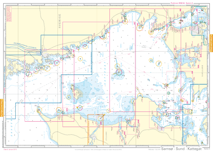
Übersichtskarte Serie 3 1 : 520.000Skagerrak 1 : 520.000
S 30 Kattegat Südwest 1 : 200.000
S 30A Kattegat Südost 1 : 200.000
S 31 Kattegat Mitte West 1 : 200.000
S 31A Kattegat Mitte Ost 1 : 200.000
S 32 Kattegat Nord 1 : 180.000
Coastal Charts
S 26 Sund Nord 1 : 80.000S 27 Isefjord 1 : 65.000
S 27A Roskilde Fjord Nord 1 : 42.000
S 27B Roskilde Fjord Süd 1 : 42.000
S 28 Samsø Belt 1 :108.000
S 29 Aarhus Bucht 1 :100.000
S 34 Randers & Mariager Fjord 1 : 56.000
S 35 Sund Nordansteuerung 1 : 65.000
Details
S 26 Helsingør 1 : 25.000S 27B Gershøj Selsø Ansteuerung 1 : 25.000
S 33 Ansteuerung Frederikshavn 1 : 40.000
S 33 Frederikshavn 1 : 20.000
S 33 Ansteuerung Hals 1 : 45.000
S 34 Udbyhøj 1 : 18.000
S 34 Hadsund Brücke 1 : 16.000
S 35 Hallands Väderö 1 : 40.000