nv-charts Reg. 6.1, Virginia & North Carolina Coast, Norfolk to Cape Fear, ICW


Description
nv-charts Reg. 6.1, Virginia & North Carolina Coast, Norfolk to Cape Fear, ICW
Format: Kombipack Papier / Digital cd and App- • CD with Charts
- • Coastal Charts
- • Revierkarten
- • Details
- • GPS Charted Waypoints & Approaches
Practical to use and accurate in the information and data published: This is the basic concept with which we have developed the nv-charts.
Scales
Passage Charts
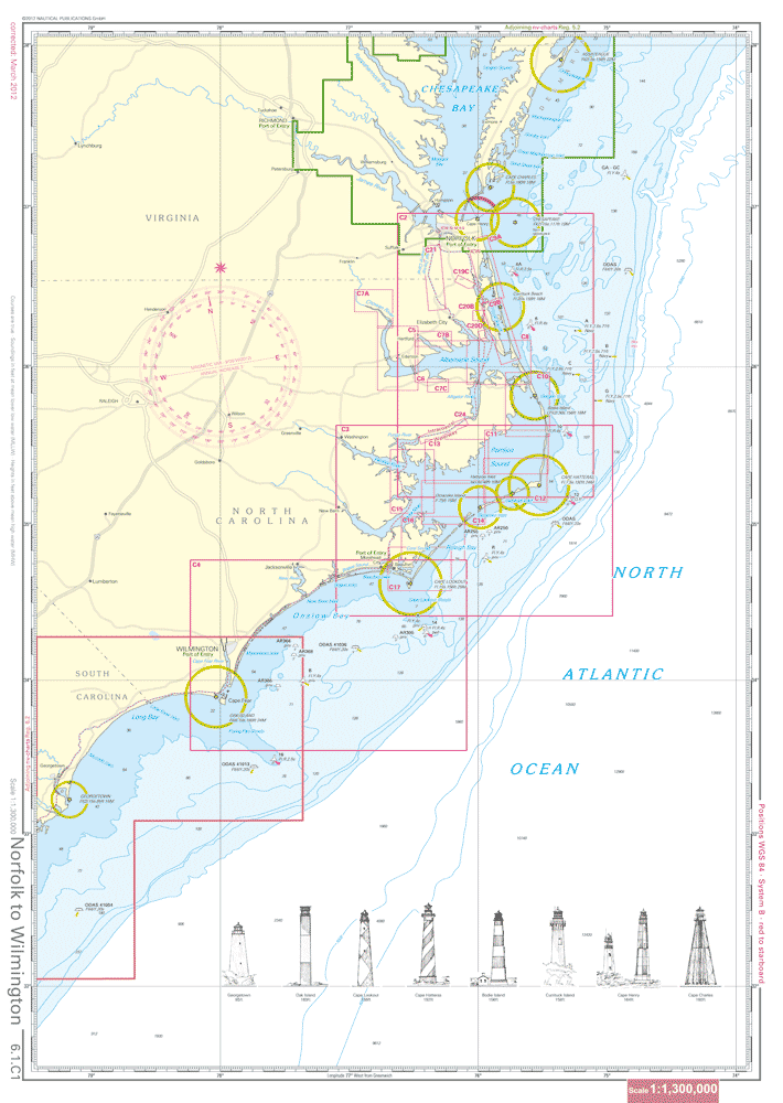
C1 Norfolk to Wilmington 1: 1,300,000C2 Cape Henry to Cape Hatteras 1: 340,000
C3 Cape Hatteras to Cape Lookout 1: 340,000
C4 Cape Lookout to Cape Fear 1: 340,000
Coastal and Detail Charts
C5 Albemarle Sound · West 1: 80,000C6 Albemarle Sound 1: 80,000
C7A Chowan River 1: 80,000
C7B Perquimans & Little River 1: 80,000
C7C Scuppernong River 1: 80,000
C8 North River to Alligator River 1: 80,000
C9 Currituck Sound 1: 80,000
C10 Croatan Sound to Pamlico Sound 1: 80,000
C11 Pamlico Sound · Northeast 1: 80,000
C12 Pamlico Sound · Southeast 1: 80,000
C13 Pamlico Sound · Northwest 1: 80,000
C14 Pamlico Sound · Southwest 1: 80,000
C15 Pamlico Sound · West 1: 80,000
C16 Pamlico Sound to Core Sound 1: 80,000
C17 Core Sound to Beaufort 1: 80,000
C18 Norfolk to Albemarle / Chesapeake Canal 1: 40,000
C19 North Landing River 1: 40/80,000
C20 North River 1: 40/80,000
C21 Dismal Swamp Canal to Pasquotank River 1: 40/80,000
C22 Pasquotank River · South 1: 40,000
C23 Alligator River 1: 40,000
C24 Alligator River to Pungo River 1: 40/80,000
C25 Pungo River 1: 40,000
C26 Goose Creek Island 1: 40,000
C27 Pamlico River · West 1: 40,000
C28 Pamlico River · East 1: 40,000
C29 Bay River 1: 40,000
C30 Neuse River · East 1: 40,000
C31A Adams Creek 1: 40,000
C31B Lookout Bight 1: 20,000
C32A Adams Creek Canal 1: 40,000
C32B Washington 1: 40,000
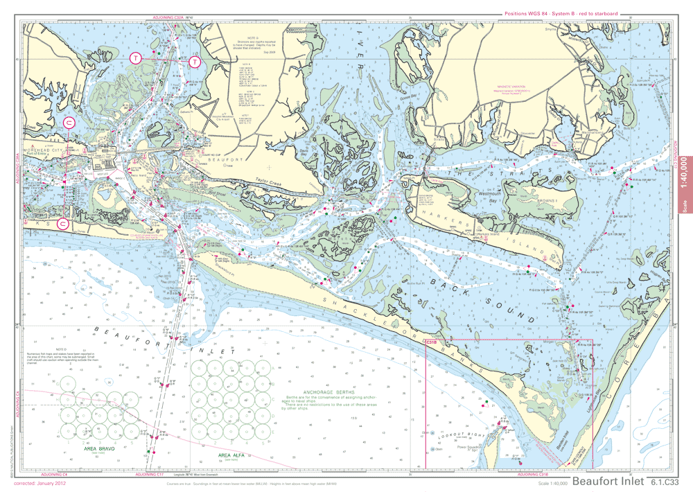
C33 Beaufort Inlet 1: 40,000
C34 Neuse River · West 1: 40,000
C35 Neuse River · Middle 1: 40,000
C36 Ocracoke Inlet 1: 40,000
C37 Core Sound 1: 40,000
C38 Bogue Sound 1: 40,000
C39 Bogue Inlet to Stump Sound 1: 40,000
C40 Stump Sound to Masonboro Inlet 1: 40,000
C41 Masonboro Sound to Cape Fear River Entrance 1: 40,000
C42 Cape Fear 1: 40,000
C43 Cape Fear River 1: 40,000
C44 New River 1: 20/40,000