


About us
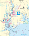
The NV.Charts are especially designed with the requirements of the yachtsman in mind. Fine contours and easy to distinguish colour graduations of the depth lines – like turquoise for coral reefs, red for the 2-meter-line and blue for the 5-m-areas – characterise the NV. Charts. Presented in a handy, user friendly size, (A2 or 23½’’ x 16 ½’’) a thick plastic envelope protects the charts, enabling them to be easily stored. The importance of good graphical representation of the topography when sailing is essential. Well marked rivers, towns and street plans all help to give a clear overall view of the shore side facilities of the coasts.
Coordinates based on WGS 84 enable yachtsmen to navigate using their GPS equipment. Large scale approaches and land contour markings simplify the entrance into anchorages.
The company’s philosophy is “to deliver everything a recreational boater needs for navigation, in one package, at a reasonable price”. Therefore all charts are delivered as chart packages, which include paper charts, a companion CD and in most areas an accompanying Harbour & Anchorage Pilot book, where more detailed information is required for safe local navigation. The companion CD includes the same charts in digital format and a GPS ready navigation software, turning your PC into a chart plotter. You just need to provide a connection from your GPS to your PC.
NV. Charts are used by the US Coast Guard between Miami and Grenada
nv-charts contact:
NV Charts,
601 Deale Road Deale, MD 20751 USA
Phone: 401-630-4333
usoffice@nvcharts.com
CEO
Hasko Scheidt
Office hours:
monday - friday 9 AM to 1 PM