nv-charts Reg. 16.1, Bermuda Islands, Passages US East Coast, Caribbean, Europe


Description
nv-charts Reg. 16.1, Bermuda Islands, Passages US East Coast, Caribbean, Europe
Format: Kombipack Papier / Digital download and App- • Passage Charts
- • Coastal Charts
- • Details
- • GPS Charted Waypoints & Approaches
- • This Chart Region is based on BA data with a new layout, clear cartography and international chart standards
- • Standardized chart scales - passage charts 1:340,000 - 1:7,500,000 coastal charts 1:90,000 and detail charts 1:20,000 or less
Scales
Übersegler
C1 North Atlantic Ocean with General Surface Current Circulation 1: 7,500,000C2 Caribbean to Bermuda Islands 1: 3,000,000
C3 US East Coast · Bermuda Islands · Caribbean 1: 6,000,000
C4 Newport to Bermuda 1: 3,000,000
Coastal Charts
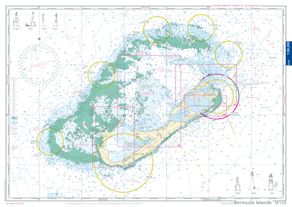
C5 Bermuda Islands 1: 90,000
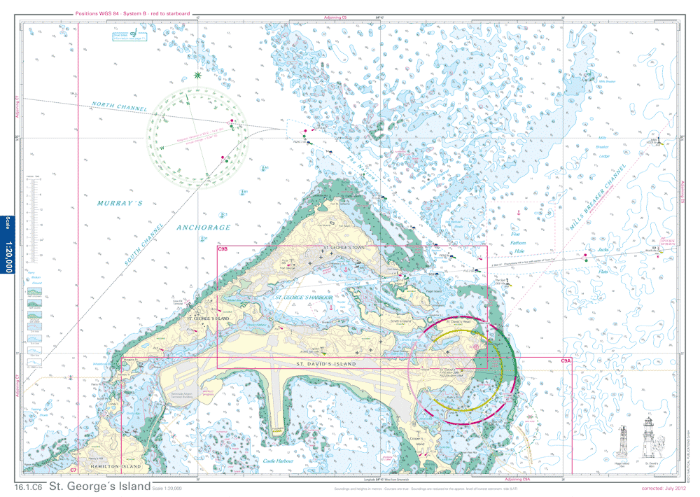
C6 St. George´s Island 1: 20,000
C7 North Channel to Hamilton 1: 30,000
C8 Great Sound 1: 20,000
Details
C9A Castle Harbour 1: 20,000C9B St. George´s Harbour 1: 12,000
C10A Hamilton Harbour 1: 12,000
C10B Ireland Island 1: 10,000
Customers also bought
USD 19,80