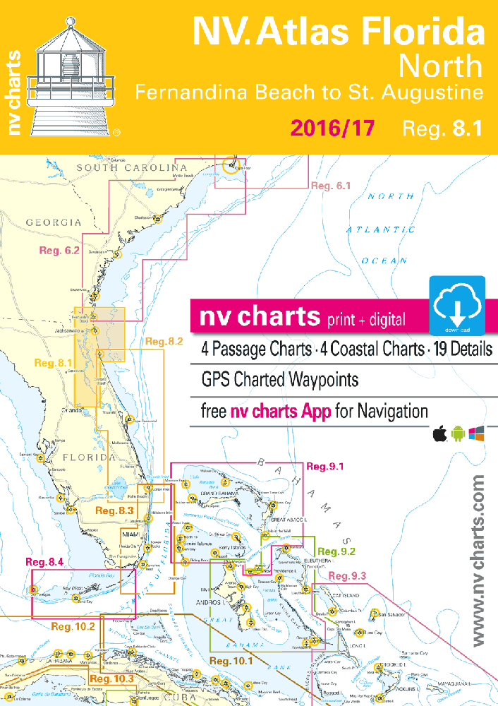
nv-charts Reg. 8.1, Florida, North, Fernandia Beach to St. Augustine

Description
nv-charts Reg. 8.1, Florida, North, Fernandia Beach to St. Augustine
Format: Kombipack Paper / Digital download and App- • Digital charts download
- • Coastal Charts
- • Passage Charts
- • Details
- • GPS Charted Waypoints & Approaches
Practical to use and accurate in the information and data published: This is the basic concept with which we have developed the nv-charts.
Scales
Passage Charts
C0 Caribbean Sea 1: 6,500,000C1 Florida North 1: 1,300,000
C2 Brunswick to St. Augustine 1: 340,000
C3 St. Augustine to Cape Canaveral 1: 340,000
Coastal Charts
C4 St. Marys Entrance · Fernandina Beach 1: 40,000
C5 Fernandina Beach to Nassau River 1: 40,000
C6 Nassau River to St. Johns River 1: 40,000
C7 St. Johns River to 202 Rd. Bridge 1: 40,000
C8 202 Rd. Bridge to Pine Island 1: 40,000
C9 Pine Island to St. Augustine 1: 40,000
C10 St. Augustine to Cescent Beach 1: 40,000
C11 Jacksonville 1: 40,000
C12 Jacksonville · South 1: 40,000
C13 Fleming Islands 1: 40,000
C14 Green Cove Springs 1: 40,000
C15 Bridgeport 1: 40,000
C16 Palatka 1: 40,000
C17 Crescent Lake 1: 40,000
C18 Welaka to Lake George 1: 40,000
C19 Lake George 1: 40,000
C20A Volusia · Lake Dexter Beresford 1: 40,000
C20B Volusia · Lake Dexter Beresford 1: 40,000
C21 Deltona · Lake Monroe 1: 40,000
C22 Lake Jesup · Lake Harney 1: 40,000
Details
C23A St. Johns River Entrance 1: 20,000
C23B St. Augustine 1: 20,000
Cruising Information · Harbor Pilot p.24-26
Introduction · Weather · Nature Information p.24-26
Legend · Notes p.27/28